The evening sky over Oakland was beginning to turn a dusty brown as Susan Piper returned to her home in the hills after a children’s birthday party with her four-and-a-half-year-old twins. It was Oct. 19, 1991, and one of the most destructive urban wildfires was just beginning.
Firefighters, in fact, contained the blaze that Saturday. The next day, though, embers reignited. By late morning, an ominous ceiling of smoke had formed over the city. The fall wind was gusty and hot. Neighbors began stirring — some standing on rooftops for a better view, others milling about in the street, many calling one another and the fire department from their landlines, hoping to learn if there was any cause for concern.
Panic erupted as a raging fire appeared over a ridge and plowed through the wooded neighborhood at the north edge of Oakland. The Piper family clambered into their two vehicles and drove down Hiller Drive and onto Tunnel Road, where bumper-to-bumper traffic stalled their escape. Flames burned on both sides of the road. Piper turned onto a side street and wound her way down the hill. A grove of eucalyptus trees above the Chabot Elementary School exploded into flames, and Piper said she could feel the melting heat from inside the car.
“I was afraid the street would take us right into the flames, but I didn’t tell my daughter that,” she recalled. “I said, ‘We’re almost out.'”
In fact, they were. The Piper family escaped, although they lost their house and most of their belongings in the Tunnel Fire, aka the Oakland firestorm, cited for years afterward as one of the most destructive wildfires in history. Nearly 3,000 homes burned and 25 people lost their lives.
Nearly three decades later, climate change and drought are hot topics in California, where wildfires have become a year-round phenomenon and a serious existential threat to millions of people — especially those who live in what is termed the wildland-urban interface, or WUI, suburban zones where homes are essentially nesting in semi-wild, flammable vegetation.
Last year was the most destructive fire year in California history, following a 30-year trend of increasingly large and uncontrollable blazes. This summer, flames have been roaring statewide for months, prompting mass evacuations. And wildfires are becoming more and more expensive. Firefighting costs in July alone ate up more than a quarter of the state’s fiscal year emergency budget of $442 million.
With the 2018 summer sky stained brown by smoke, it is increasingly clear that the East Bay will probably burn again. However, most fire experts and community leaders say not enough is being done to prevent the next catastrophic blaze. They want more prescribed burning to reduce fuel loads, increased funding for firefighting and wildfire research, and stricter controls on development in wooded areas.
“But that’s so politically contentious — it’s a line politicians walk up to but turn away from,” said William Stewart, a UC Berkeley forestry and wildfire specialist.
He and others have put forth a question: As homes continue to be built in the WUI, to what extent should public resources be used to protect private properties built in known hazardous areas?
“No state spends as much as California on protecting homes in the WUI,” Stewart said. He noted that firefighters must prioritize the safety of humans, “even if it means the forest has to burn.”
According to a recent analysis, more than 2 million homes in California are at high or extreme risk of wildfire damage, and Alameda County has one of the largest numbers of units at risk.
Meanwhile, debate has been raging in Sacramento about how liable investor-owned utility companies such as PG&E should be for wildfires caused by their equipment. PG&E may be on the hook for as much as $15 billion after last year’s wildfires, and is now undergoing an extensive retrofit of its power supply system. The utility district is replacing or upgrading thousands of miles of lines, replacing wooden power poles and trimming back vegetation around high-voltage hardware. While PG&E has an obligation to provide power for any residents who have built their homes and managed their properties to the company’s fire-safety standards, the utility may also be more proactive about preemptively cutting off power when the weather creates risky wildfire conditions.
At the same time, lessening the utilities’ liability could shift the burden to homeowners’ insurance companies, leading to higher insurance premiums and less coverage in some areas, and to homeowners themselves in the form of higher energy bills. Although state lawmakers recently killed a proposal to lessen PG&E’s liability for the time being, the issue likely won’t go away.
Like many high-profile fires, the Tunnel Fire prompted local and state agencies to undertake wildfire mitigation efforts, but they didn’t get very far. Thinning of eucalyptus trees — known to be highly flammable — has been slowed or halted by litigation from a local homeowners group, and a local Wildfire Prevention Assessment District — basically a vegetation clearing task force funded by city taxes — has struggled to receive voter support. Critics argue that clearing all vegetation could present its own fire risk. As for building in hazardous areas, the California Department of Forestry and Fire Protection, or Cal Fire, has mapped out the state by wildfire risk for the purpose of informing county agencies in granting building permits, though this hasn’t slowed development in even the highest-risk parts of the state.
“People seem to have short memories,” said Sabrina Drill, a natural resources advisor for the UC Cooperative Extension, a statewide off-campus division of the university system that focuses on agriculture and natural resources. “I think people might think twice about building a home where there had just been a fire, but people seem to forget after about three years.”
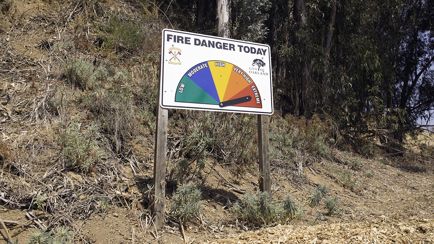
[pullquote-1]The City of Oakland recently released a draft vegetation management plan that outlines risk areas and generally describes actions that could mitigate fire hazards.
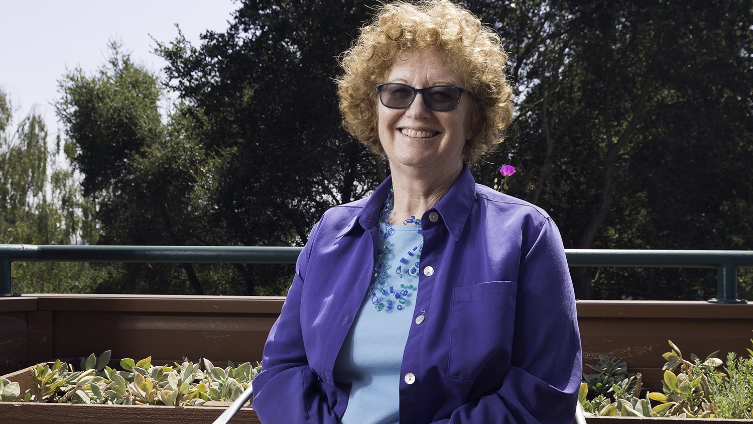
Piper, who chairs the Oakland Firesafe Council, a fire prevention advocacy group, doesn’t think the long-awaited plan amounts to much. “It provides almost no detail on actual projects — just guidelines and recommendations,” Piper said. “It’s hot air.”
She said dense groves of eucalyptus and thickets of flammable French broom are overgrown to dangerous levels throughout the hills, and that Oakland officials are essentially ignoring a looming threat.
Piper lives in a rebuilt home on the same property she occupied in 1991, and she, perhaps more than most Californians, has cause for concern. “Where fires happen once, they happen again,” she said. “Just look at Lake County — they’ve had three fires in five years. It’s been almost 30 years in the East Bay. We are overdue.”
In 2017, two wildfire events in California — the North Bay fires and the Thomas Fire near Ventura — burned almost 600,000 acres of land and killed 46 people. It was California’s deadliest and all-around most destructive year of wildfires, with flames consuming a total of 1.3 million acres.
The summer of 2018 has already seen some enormous blazes in Mendocino, Lake, and Napa counties, another near Yosemite, where a firefighter was killed in the line of duty, and a large and aggressive fire that threatened much of Redding in late July and killed at least seven people.
“If what we’re seeing this summer is the new normal, it’s imperative we act now and try and mitigate the fire risks and not just wait until the next fire happens,” said Senator Bill Dodd, a Democrat from Napa who has proposed two bills that would hold utility companies — whose power lines are a frequent ignition source — to higher levels of accountability in fire prevention and damage.
A variety of factors are making fires larger and more frequent. For decades, flawed forest management policies mandated that firefighters extinguish virtually every wildfire they could. This allowed immense volumes of fuel which would have been eliminated by small semi-annual fires to build up in the state’s forests. Tens of millions of trees died during and after the drought of water stress and bark beetle infestations, adding to the accumulating fuel load. Now, the long era of fire suppression is backfiring as large fires consume the enormous aggregations of woody debris in blazes so large that firefighters can often only watch them burn.
The warming planet, with higher average temperatures accompanied by more extreme droughts and winters, is worsening the wildfire trend. The exceptionally wet winter of 2016-17, for example, prompted tremendous vegetation growth. Then came the hottest summer on record, with a record-setting heatwave on Labor Day weekend that dried much of California to a crisp and primed the state to explode into flames weeks later.
The fires have sparked discussion over residential development in California’s woodlands. The devastating Tubbs fire, which burned through Santa Rosa last fall, came as a near repeat of the Hanly fire of 1964, which mapping analyses show occurred in almost the exact same footprint as the later disaster.
“But in 1964, almost nobody lived out there, and they lost 150 homes,” said Jerry Kent, a Lafayette resident who, when he was the assistant general manager of the East Bay Regional Park District, helped local firefighters contain one section of the Tunnel Fire. “This time, they lost almost 6,000.”
That’s because development in the wildland-urban interface has skyrocketed — often in spite of known fire hazards. One in seven homes in California — about 2 million all told — have been built in areas deemed to be at high or extreme risk of wildfire, according to Verisk Analytics, an insurance data provider. Van Butsic, a UC Berkeley researcher who studies forestry and land use, has closely studied this. In a paper now under review for publication, he and scientist Anu Kramer, from the University of Wisconsin, describe an alarming trend of building homes in known fire-risk areas.
“We studied 30 of the largest fires since 1970,” he said. On average, they found that 20 years after an inhabited area burns, not only were most of the destroyed homes rebuilt but many new homes were added — about twice as many homes in total as there were at the time of the burn.
[pullquote-2]“It shows there isn’t a lot of adaptation based on fire history,” Butsic said. “California is in a housing crunch, and also there are tax benefits that communities see from allowing development.”
For instance, the upscale Fountaingrove neighborhood in Santa Rosa that burnt to ashes in the Tubbs fire had also burnt in the 1964 Hanley fire, before it was developed. It is now being rebuilt.
When people choose to live in a known fire risk area, it seems they don’t think much about it — or they’re willing to take chances.
“Even in the highest-risk parts of the state, like in San Diego County, there’s the chance that fire engines might be parked in front of your house once in 80 years, and people tend to think, ‘I’ll just roll the dice,'” Stewart said.
Most wildfires in California are started by human activity, said Butsic, and as the number of homes in the WUI has increased, so has the number of wildfires.
Research has shown that firefighting costs are dramatically higher if there is just a single inhabited structure in a burning area.
“The cost of firefighting skyrockets as soon as there is just one house,” Butsic said. “It’s not proportional, either. It’s goes way up if there’s one house to protect or if there are 100 houses.”
He said the costs associated with protecting an area from fire plunge when there’s much more housing density.
“Like where I live on the flats of Oakland, there’s almost nothing to burn,” he said.
The effect of this development-to-cost relationship is an inverted U-curve that illustrates the high price of allowing scattered homes in the WUI. When fires burn there, firefighting crews become obligated to guard the properties from flames.
“If there are too many homes at risk, they bring in firefighters from the Bay Area and all these other urban areas where salaries are high, and it gets very, very expensive,” said Mike Kirkley, formerly a Cal Fire chief who retired nine years ago, just before the West’s wildfires seemed to jump noticeably in magnitude and severity.
Costs have ballooned, too. From 2000 to midway through 2007, the state spent an average of $166 million per year on fire suppression, according to Cal Fire records. An equal length of time one decade later, ending in June 2017, saw a doubling of costs — $310 million per year. In the 2017-18 fiscal year, California spent $773 million fighting fires. In July alone, the first month of the new fiscal year, the state spent $114 million fighting wildfires.
[pullquote-3]Who should be covering these costs is a question many have asked. For a time, California had an effective system in place of taxing homeowners living in high-risk fire hazard zones to recoup the costs of protecting their properties. The State Responsibility Area Fire Prevention Fee was initiated in 2011 and required residents in the carefully mapped risk zone to pay the state an annual fee of $156 per habitable structure. Over the next five fiscal years, this system generated $112 million for Cal Fire for wildfire prevention and protection.
“But Republicans hated it because it was basically a tax on their constituents,” Butsic said. Last July — just three months before the apocalyptic North Bay fires — Gov. Jerry Brown discontinued the program, which effectively loaded firefighting costs back onto California taxpayers.
Community-level fire prevention programs have also struggled to garner sufficient funding. For instance, only a few cities have been willing to pay for their own wildfire prevention assessment districts, as Oakland did from 1992 to 1997 and 2003 to 2013.
“Even fairly affluent cities in high-risk areas haven’t been willing to fund these assessment districts,” Stewart said.
Oakland’s wildfire assessment district drew $65 per year per single-family dwelling and generated about $1.8 million annually for fire prevention measures. In 2013, voters chose to terminate the tax that funded the district, leaving the small agency to live feebly off its coffer savings before they ran out in 2016.
“I live in a relatively low-income county where these fees are controversial, but in the affluent East Bay, people really can’t argue that they can’t afford to support such a program,” Kirkley said.
Just as Oakland did after the 1991 disaster, the City of Berkeley initiated a program to support firefighters burdened with the chore of protecting homes in highly vegetated, high-risk areas. It was started in 1997 and discontinued after several years. The city’s fire department remains busy with inspections, said Keith May, the assistant chief of special operations with the Berkeley Fire Department. He said three department inspectors make about 1,300 neighborhood inspections each year of dangerous vegetation on and around private properties. Many of them result in enforcement actions, though May notes that the process of forcing a landowner to, say, trim or remove a tree is a long one.
“It can take six or eight months, and by then you’re into the next fire season,” he said.
Some feel California and its 58 counties, 40 million people, and countless small fire districts have been hamstrung by disorganization as agencies and leaders debate fire prevention strategies.
“It’s very confusing,” Kent said. “No one’s in charge, not even Cal Fire, so it’s a mess out here. Twenty-seven years after the Oakland fire and we still don’t have a plan.” He said the East Bay “is in significant trouble.”
[pullquote-4]To mitigate this risk, the City of Oakland, along with the Oakland Fire Department, just released a draft vegetation management plan to address vegetation-related fire hazards. The 214-page document cites overgrown problem areas and generally aims “to evaluate the specific wildfire hazard factors in the Plan Area and provide a framework for managing vegetative fuel loads.”
Piper thinks Oakland officials should be providing specific, detailed plans for trimming vegetation and removing trees where needed.
“We want a vision for what a managed wildland-urban interface should look like, but the city hasn’t provided one,” she said.
The Oakland Fire Department declined to comment, and the city did not respond to an email request.
Andrea Pook, a spokesperson with the East Bay Municipal Utility District, said her agency uses grazing animals — cows, horses, and goats — to trim vegetation, specifically for the purpose of controlling potentially dangerous fuel loads. She said the district’s rangers are trained in wildfire response protocol, including “live fire training,” and that they consult routinely with Cal Fire, surrounding county governments, and the Moraga-Orinda Fire District on wildfire prevention and firefighting measures. Hillsides burned by wildfire may be vulnerable to rapid erosion, which can impact water quality in streams and lakes.
“Our main focus with these measures is to protect the East Bay’s water supply,” Pook said.
While Gov. Brown signed an executive order accompanied by $96 million in May to ramp up forest management and restoration projects, including more prescribed burns, Stewart said he isn’t impressed by the state’s actions in the wake of last year’s fires. The 2018 budget was finalized just weeks after the record-sized Thomas Fire, which killed one person, was extinguished.
“The new budget gave Cal Fire 60 new firefighters and a fire and fuel specialist,” Stewart said. “That’s all they got after last year.”
He said society tends to be concerned about wildfires during and immediately after high-profile catastrophic events. However, the attention is often short-lived and doesn’t generate change before the next fire strikes.
“It’s surprisingly hard to get investments in fire prevention strategies, even after the scale of the fires we just had,” Stewart said.
PG&E, however, is spending about $1 million per mile of power line to replace or upgrade infrastructure that passes through high-fire risk areas. The utility company maintains about 81,000 overhead circuit miles of lines in California, with about 7,100 miles passing through what Cal Fire classifies as “Tier 3” — extreme fire risk areas. Much of the East Bay hills, the Santa Cruz Mountains, and the North Bay are deemed Tier 3.
A longtime employee in the company’s electric department who spoke to the Express on the condition of anonymity said the upgrade work will take about 15 years to complete at a target pace of some 400 miles per year. Overhead power lines, which are generally bare copper, are either being moved underground or replaced with coated wires that resist sparking when struck by tree limbs. Because protected lines are heavier, this will require the replacement of hundreds of thousands of utility poles.
“In my 33 years with the company I have never seen such an organized effort to install so much insulated covered tree wire, heavy-duty poles, and protective equipment for the electric system,” the PG&E employee said. “The infrastructure being installed is unprecedented. We are now installing multiple times the amount of infrastructure a year from previous years, and we have never been at such a rapid pace of tree removal and trimming.”
Arborists are helping direct the tree trimming and removal work, the source said. Just recently, a beekeeper was called to remove a colony of honeybees that had built a hive on a power pole.
“That’s just one example of the effort we’re taking to minimize environmental impacts,” the employee said.
Scores of weather stations are being installed throughout the company’s service area. These will measure such conditions as temperature, relative humidity, and wind speed and allow the company’s system managers to determine if and when to shut off power as a protective measure against wildfires. The utility company recently announced a new protocol for turning off a region’s electricity when weather conditions develop — especially strong winds — that could start a wildfire along a powerline.
The source noted that PG&E is “in a delicate situation” of trying to deliver power to customers, many of whom live deep in the woods, “while being good stewards to the forest.”
While the average size and severity of wildfires grows, there is little serious talk in California of restricting building in the wildland-urban interface.
“Local governments aren’t very excited about telling people how or where to build their homes,” Stewart said. “These are elected officials, and they would be telling their constituents what to do on private property.”
But this hands-off approach to governing private land doesn’t apply everywhere. In 2016, researcher Susan Kocher spent nine months on sabbatical in Provence, the arid region of southern France that resembles much of inland California. Here, Kocher — the Central Sierra Natural Resources Advisor for the UC Cooperative Extension — compared building patterns in high-fire risk parts of California and France.
“In California we often say, ‘We should be able to tell people they can’t build here,'” said Kocher, whose research, coauthored with Butsic, was published in March of 2017 in the journal Land. “In France, they just tell people they can’t build somewhere.”
[pullquote-5]Kocher and Butsic observed that the French government tends to be more involved in building regulations. Building in very high-risk areas has been prohibited, and in exceptional cases properties can be expropriated “if displacing people whose life is threatened by a risk proves to be the only solution at an acceptable cost,” they wrote in their report.
By contrast, many local officials in California have ignored fire hazards and allowed risky development, said Kocher and Butsic. For example, after the Oakland hills firestorm, a state law was passed requiring mapping of high-risk fire areas. Although the City of Oakland strengthened its building and fire-prevention codes by placing more regulations on the separation of buildings, ventilation criteria, and other fire-mitigation measures, they also permitted rebuilding of nearly all the destroyed homes, allowing many of them to increase in size. “Such disregard for fire hazard by local authorities is more difficult in France,” the authors wrote. In general, California seems to lag in government oversight of fire-safe building, and it’s likely there are too many at-risk homes for public agencies to reliably inspect for safety codes and protect from fires. This puts the onus on homeowners to manage their own properties — something millions of the state’s homeowners probably don’t do adequately.
While destructive wildfires, in theory, help illustrate problems with standard building codes, Stewart noted that they don’t necessarily lead to improvements in the regulation systems that govern homebuilding.
“After a fire, there tends to be very little interest in making new regulations or doing anything that makes it harder for people to rebuild,” he explained.
Gov. Brown did at least mention the issue at a recent press conference in Redding, as the Carr Fire burned close by.
“We’ve got to reexamine how we manage our forests, build our houses, how we build them and where we build them, and how much we invest in fire protection services,” he said.
However, county agencies are reportedly expediting permitting processes for rebuilding after last year’s North Bay fires, especially if submitted plans replicate what was there before. Stewart said lawsuits against PG&E — widely blamed for starting the Wine Country firestorm — are likely to produce cash rewards for fire victims, but not soon enough to protect communities with higher-standard structures.
“By the time the lawsuits are finished, the homes will be rebuilt, and it’ll look like 1990 again,” he said.
[pullquote-6]Many housing developments in the WUI were built decades ago and do not meet current fire safety standards. Many have roads too narrow for fire engines.
“Up in the East Bay hills, some of those roads are so narrow and winding that I do think evacuation would still be a problem,” Butsic said.
Some communities have just one road in and no second escape route. Some older subdivisions have no public water, which means firefighting vehicles must haul it in. The explosion in WUI development has come with stricter property codes — like the defensible space rule that, since 2005, has required that homeowners keep 100 feet of space surrounding their properties relatively clear of vegetation fuels, especially in the first 30 feet. Many modern homes are built of fire-resistant materials.
But even WUI developments built in compliance are not safe from the most destructive, hottest fires. Not so long ago, Stewart visited a housing development in a rural area that had been built following the highest fire safety standards. Vegetation had been cleared as required, and the homes were built of fire-resistant materials.
“They even had a second road system just for firefighters,” Stewart said. “I had never seen that before.”
But it didn’t matter. That development was the upscale Fountaingrove neighborhood in Santa Rosa, and it had just been reduced to ashes by the Tubbs fire. It was the second time the area had been overwhelmed by flames in 53 years.
Drill, with the UC Cooperative Extension, believes government should eventually, if not now, step in and impose some level of restriction on new development in areas known to be at risk of burning.
“New developments really need to be looked at more carefully, and when new areas are being proposed for development, maybe we should have to look back at 100 years of fire history first,” she said.
Pook, at East Bay MUD, said she lives in a house abutting the property of the East Bay Regional Park District. She noted that somebody needs to live in the WUI.
“There’s always going to be an interface — you can’t prevent that,” she said. In other words, somebody will be living at the edge of a city, no matter where the boundary against the wilderness is established.
Her nearby neighbor, Martin Hevezi, also lives at the boundary of East Bay MUD property. He said he recently spent $1,000 to remove dangerous brush and trees on the property surrounding his house, which was built in the 1970s. He said he sees “half-assed” efforts from the city to do the same on its own land.
“The amount of taxes we pay to live here is pretty high, and we do expect there to be a little more effort by the city” to address dangerous vegetation, he said.
But nearby roadways are lined with overgrown trees, he said, and a recent grass-cutting endeavor along the Skyline Boulevard median left the cut vegetation in place.
“The point of cutting the grass is to get the fuel out of there and away from the houses, but they just leave it,” he said.
Pook pointed out that other natural phenomena, like storms, earthquakes, and floods, threaten very particular and well understood geographic and geologic zones, and that people can choose to live there or not. Pook said when she was in the market to buy a home, she opted against areas likely to be inundated by the rising ocean.
“I chose not to buy a house in Alameda because the sea level is rising, and now it turns out I’m in an area where I have to worry about wildfires,” she said.
California’s climate is growing warmer, and while this could eventually mean more rain, many climate scientists predict the change will result in a drier landscape. Some scientists expect the scrubby semi-desert landscape of Southern California to advance northward year by year. This might lead to less fuel on the land, though the warmer, drier climate could mean a greater likelihood of vegetation catching fire. Overall, scientists predict that global warming will lead to more severe wildfires throughout California.
Demographic trends are not helping, and as more people move into semi-rural, suburban areas — especially as they seek more affordable housing away from urban centers — the odds of wildfires breaking out increase. May, with the Berkeley Fire Department, said the pressures to provide housing for the Bay Area’s growing population continue to generate construction in areas at high risk of burning. A bill passed in 2016, SB 1069, removed a variety of legal barriers against property owners building second “granny” units on their properties.
[pullquote-7]“It seems to have led to more housing units, and that definitely puts a burden on firefighters and our inspectors,” he said.
In their Land article, Butsic and Kocher suggest that, in California, “local governments could try to develop their own restrictions on building in fire prone areas within their jurisdictions.”
“Currently, general plans [in California] must address threats from wildfire, but do not prohibit homes being built in fire prone areas,” the authors wrote. “The state could strengthen the language to require local jurisdictions to limit construction in hazardous areas and mandate design criteria.”
Stewart believes California’s government should support more research into fire-safe building patterns and more effective vegetation management. Perhaps most importantly of all, he said, Californians must turn wildfire history into a learning experience.
“If we don’t make significant investments in new ways of managing vegetation and building these housing developments in the WUI,” Stewart said, “we’re going to be on this hamster wheel forever.”